Mapping the Future of Learning at Bartleson Ranch and Conservatory

Through a client-driven GIS project, Cal Poly students are turning a 450-acre ranch into a living laboratory — applying classroom knowledge to real-world challenges while building technical skills, professional experience and a foundation for interdisciplinary discovery.
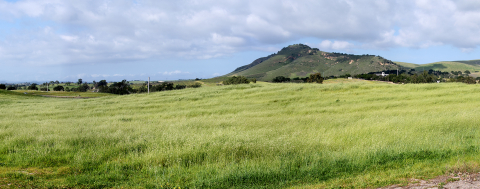
At the college’s 450-acre Bartleson Ranch and Conservatory, the landscape itself is a classroom. Through a multi-year geographic information system (GIS) mapping project, students are transforming the ranch into a living laboratory — creating a dynamic, data-rich interface that brings its natural resources and agricultural operations to life.
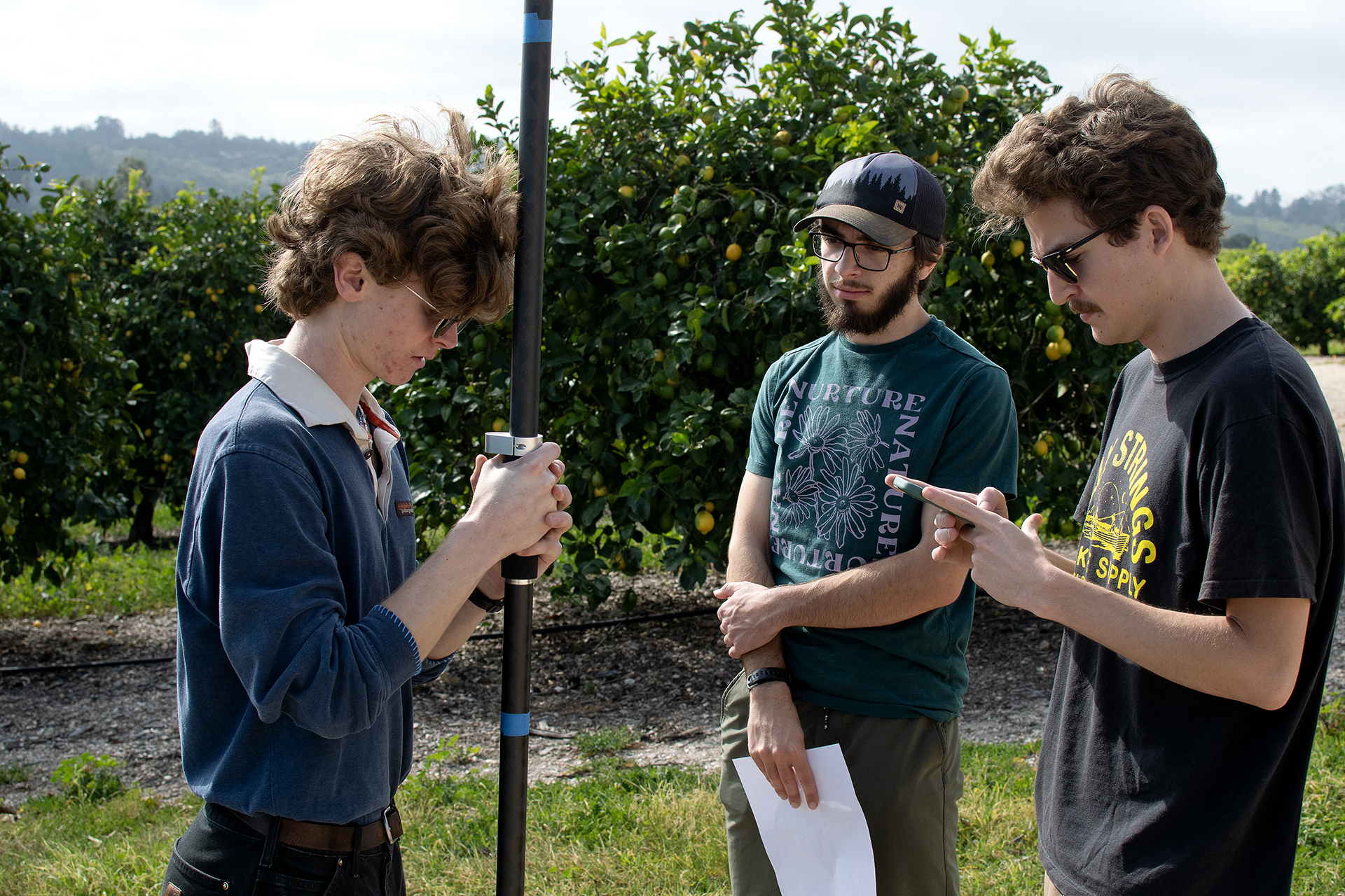
The Arroyo Grande, California, ranch donated to Cal Poly’s College of Agriculture, Food and Environmental Sciences by Stu and Jan Bartleson serves as a living laboratory for students studying horticulture, fruit science, soil science and related fields. Since 2024, Natural Resources Management and Environmental Sciences Department Lecturer David Yun has guided students in an advanced GIS course as they collect and map detailed data at the ranch, including water sources, precise plot boundaries, underground infrastructure and riparian areas. This foundational work is expanding hands-on, interdisciplinary learning and strengthening the ranch’s role as a long-term teaching and research resource for students across majors.
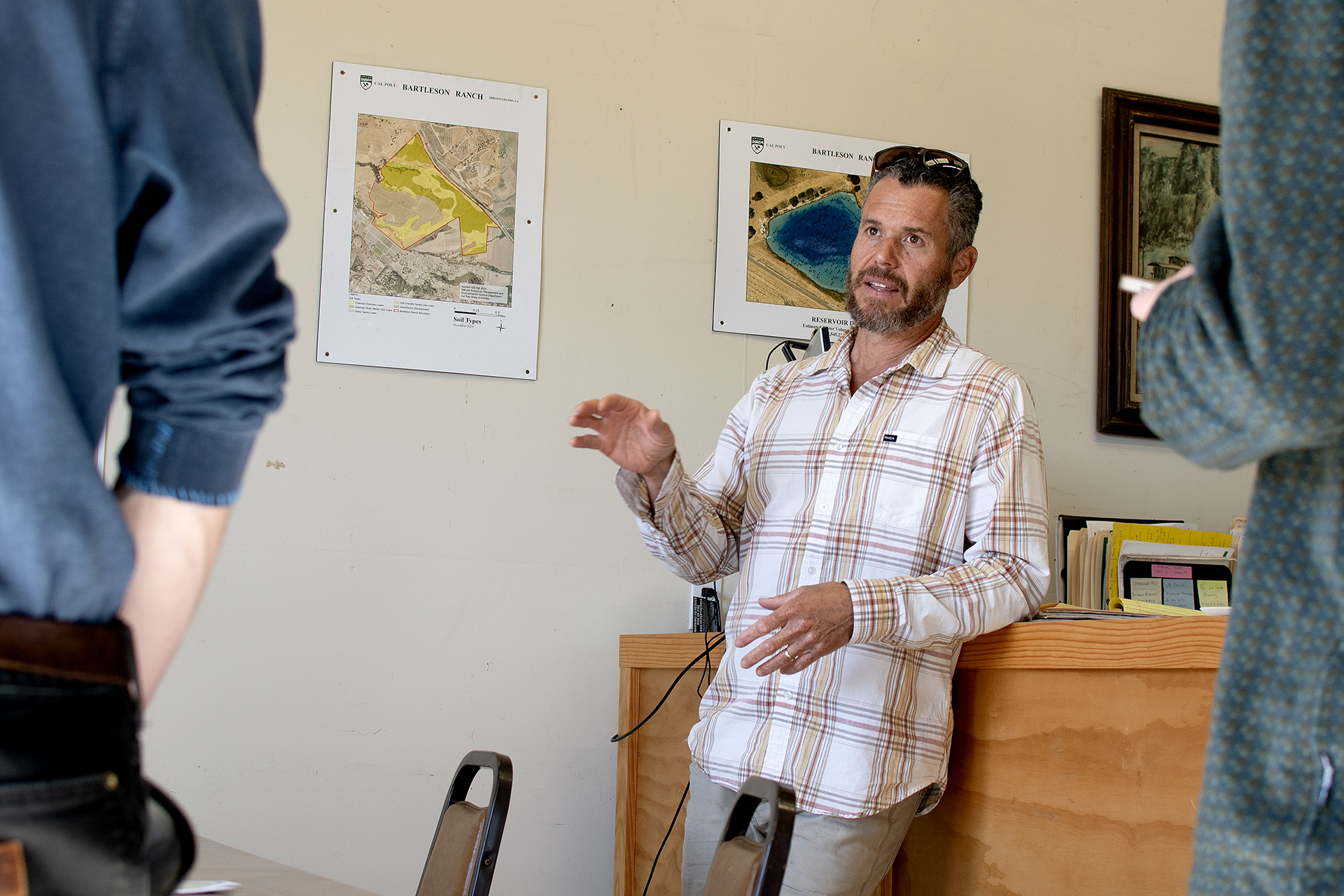
Students work directly with Bartleson farm manager Johnny Rosecrans to identify operational needs and develop data that supports both day-to-day operations and future research on the property. Prior to the student-developed GIS maps, Rosecrans relied on a hand-drawn map and the institutional knowledge of long-time employees.
At its core, GIS is a technology used to create, manage, analyze and map virtually any data. More than just a mapping tool, it connects information to place — linking location data, such as the position of wells, with descriptive details, such as infrastructure age, water levels and irrigation connections. By visualizing patterns geographically, GIS improves communication, streamlines operations, strengthens management and provides tools for resource management. “This project has been very helpful not only for providing students hands-on experience working for a real client, but also in supporting overall operations and planning at the ranch,” Rosecrans said.
The FNR 418: Applied Geographic Information System course is designed to provide a community service to the university, local governments, state and federal agencies and non-profit organizations by working on a client-driven project that teaches students not only the technical skills but the experience of networking with organization leaders, developing and executing project plans, and providing a community service. Yun, a Cal Poly alumnus who works fulltime for the City of San Luis Obispo as a GIS supervisor, has taught GIS part time at Cal Poly for more than 28 years because of his passion for it.
Working directly with a client and linking software, technical and analytical skills with field work was an opportunity that brought together everything we have been learning in our courses." — Elli Wooten, fourth-year environmental management and protection major
“In this course students get to directly apply what they are learning,” Yun said. “When they are doing it on their own they have to work through creating a product that satisfies their client and remedy any challenges along the way. That experience — learning to work through the problems they encounter — is the process of learning.”
Fourth-year soil science major Bryn Thornton was part of the inaugural class that began the project, creating the first map layers that future classes would build upon. Thornton and five other students worked with Rosecrans to define project goals and assess existing resources. By the end of the 10-week quarter, the students had built a 19-layer dynamic database that included detailed soil maps, an exact count of every tree on the property and the boundaries of each plot — critical information for nutrient management and irrigation in the ranch’s lemon groves.
“To see the information in place speaks volumes to the power of GIS,” Thornton said, adding that it is a dynamic tool that allows users to use varying layers of information to show different relationships. “After this experience I appreciate the power of these spatial visualization tools even more,” she said. “To see how amazed Bartleson’s manager was with what we were able to do with it was a proud moment. It blows my mind all of the things it can do.”
Fourth-year environmental management and protection major Elli Wooten helped lead the third cohort of students working on the project, building on the initial framework by focusing on water assets and volume calculations. She and a team of nine students mapped the ranch’s 3.5-acre reservoir to determine its holding capacity. “We used a little rowboat to collect data points and measure the 12-foot-deep reservoir,” she said. Students also mapped underground utilities and site wells, creating a visual tool to support irrigation management and future planning. “This allows the farmer to directly interact with the system,” she said.
"To be able to do this work on a ranch that your university owns just 20 minutes from campus is pretty incredible,” Wooten said. “Working directly with a client and linking software, technical and analytical skills with field work was an opportunity that brought together everything we have been learning in our courses.” Wooten plans to pursue a master’s degree at Cal Poly, with the goal of building a career using GIS and satellite imagery applied to sustainable agriculture. “This experience helped me solidify that decision,” she said.
The visual maps built by students now hang on the office walls where Rosecrans works each day. He references them often and uses them as a tool to demonstrate the ranch’s resources when students visit. “We’re really excited to continue expanding interdisciplinary learning at the ranch beyond traditional agricultural uses — there is so much more potential here than simply growing crops,” Rosecrans said. “This is just the first step in many hands-on learning opportunities to come.”
Visit Cultivate Spring 2026 to read more stories.


