Drone Assisted Surveying
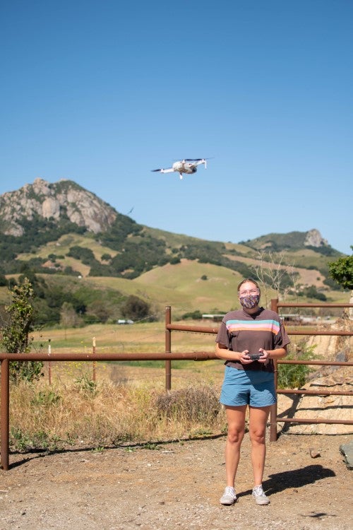
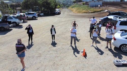
Students stand clustered in a dirt parking lot, underneath the blaring heat of an early spring day, their eyes cast to the sky as a steady buzzing sound emanates from above. A small drone, not much bigger than the palm of an outstretched hand, hovers overhead.
The students are enrolled in a drone-assisted surveying course — the first of its kind offered by the BioResource and Agricultural Engineering Department. The burgeoning use of drones, also known as unmanned aerial vehicles (UAVs), to map land is changing the way that land surveying is done — making the process of creating maps more efficient. The department purchased six minidrones and two larger ones for students to gain hands-on experience.
The nine students taking the course are mostly upperclassmen from a range of majors across the university, including environmental management and protection, construction management, and bioresource and agricultural engineering. Augustina Mogetta, a fourth-year environmental management and protection major, took the course to fulfill a minor in geographic information systems. “There is a whole world out there for drone applications,” said Mogetta, who has accepted a job within the city of San Francisco’s environmental outreach programs. “While I may not use drones in my job, it is good to know the interest of the stakeholders I will be working with.”
Lecturer Lewis Soloff, who has worked for years as a land surveyor, said that what would have once taken several days to do can now be done in a matter of minutes using the advanced technology. Land is surveyed to determine property boundaries and topography of the parcel being surveyed. Soloff has students flying the smallest of the drones on their second day of class — learning how to navigate the controls from their smartphones. “I want the students to approach this emergent technology with confidence,” said Soloff. “I encourage them to be bold but to follow the safety protocols.”
Students learn aviation and safety laws, how to operate both large and small drones, and how to become certified to fly drones for commercial purposes by obtaining the Remote Pilot Certificate from the FAA. Soloff said students are likely to use the technology beyond mapping for other practical uses, such as quickly inspecting large areas of farmland to survey plant health, or in forestry, to study drought impacts, or to distinguish what types of trees are grouped in particular areas.
“Surveying a 10-acre site with modern ground instruments might take two days with a two-person crew,” said Soloff. “Now, a drone can fly for eight minutes and capture the same imagery. The increase in productivity is almost unbelievable, and of all the possible applications of drones, most people in the field consider that agriculture stands to gain the most from this technology.”
The examples are endless. Infrared technology can be used to make a map in a single afternoon to determine where problem areas are, such as an aphid infestation. A 30-acre site can quickly be surveyed to see where water flows, or doesn’t, and determine problem areas and find resolutions. “There are huge cost and ecological benefits,” Soloff said.
Visit Cultivate Summer 2021 to read more stories.


